Hurricane Trudy reaches category 2 with 100mph winds off Mexico
Hurricane Trudy strengthened to category 2 with 100mph sustained winds off Mexico's Pacific coast on Saturday, with a hurricane warning from Manzanillo to Cabo Corrientes and 4-8in of rain forecast.
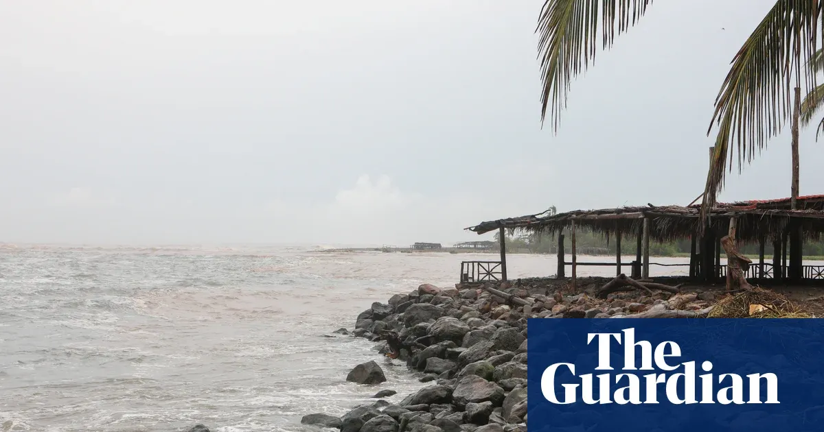 Photo: The Guardian
Key points
Hurricane Trudy strengthened to category 2 with 100mph winds off Mexico's Pacific coast, with a hurricane warning from Manzanillo to Cabo Corrientes.
Hurricane Trudy strengthened to a category 2 hurricane as it moved toward Mexico's south-western and west-central Pacific coast on Saturday, the US National Hurricane Center said. Maximum sustained winds reached 100mph (155km/h). The storm sat about 115 miles (180km) south-south-west of Manzanillo and 205 miles (330km) south-south-east of Cabo Corrientes, moving north-west at 10mph (17km/h).
A hurricane warning was in effect from Manzanillo in Colima state to Cabo Corrientes in Jalisco. The warning matters because it signals hurricane conditions expected within about 36 hours, giving coastal communities time to prepare. Trudy's centre was expected to approach the Mexican coast on Saturday and pass near it into Sunday, according to the National Hurricane Center's forecast track.
Warnings cover Manzanillo to Cabo Corrientes
Mexico's government issued a tropical storm warning for Las Islas Marias and discontinued a similar warning for its coast south of Lazaro Cardenas. A tropical storm warning means tropical-storm-force winds are expected, a lower threshold than the hurricane warning covering Manzanillo to Cabo Corrientes. The differing alerts show the storm's damaging wind field is narrower than its rain footprint along the coast.
Trudy was expected to bring 4-8in (10-20cm) of rain through the weekend, with isolated totals of about 15in (38cm). The National Hurricane Center separately forecast 4 to 8 inches with isolated higher totals around 12 inches for Michoacan, Colima and Jalisco, and 2 to 4 inches with isolated totals around 6 inches for Guerrero and Nayarit. Rain of that volume on saturated ground raises flood risk.
Colima authorities said the risks remained low, but warned that heavy rainfall could cause damage because the ground was already saturated by successive storms along the Pacific coast. That saturation is the mechanism turning ordinary rainfall into flooding: soil that cannot absorb more water sends runoff into rivers and streets. The National Hurricane Center said the rainfall might produce life-threatening flooding and mudslides.
Rainfall totals and saturated ground
The Mexican navy urged mariners and coastal residents to exercise extreme caution because of high waves, heavy rain and the risk of rising rivers, flooding and landslides in vulnerable areas. Hurricane-force winds extended outward up to 35 miles from Trudy's centre, while tropical-storm-force winds reached up to 140 miles, defining the zone where dangerous conditions could occur even away from the eye.
The National Hurricane Center said Trudy would move north-northwestward through Sunday, then turn toward the northwest on Sunday night. On that track, the centre would approach the coast of south-western and west-central Mexico in the afternoon and pass near the coast that night and into Sunday. The storm's forward speed of 10mph means its rain bands will linger over the same coastal areas.
Navy warns of waves and landslides
Warnings and watches covered overlapping stretches of coast: a hurricane warning from Manzanillo northward to Playa Perula, a hurricane watch from Manzanillo north to Cabo Corrientes and from Manzanillo south to Punta San Telmo, and a tropical storm warning for Las Islas Marias. Watches mean hurricane conditions are possible; warnings mean they are expected, so preparation deadlines fall sooner under a warning.
Trudy formed in a Pacific season already strained by successive storms. The National Hurricane Center warned the rainfall could produce life-threatening flooding and mudslides along the coast of south-west Mexico. The combination of a category 2 wind field, a slow 10mph track hugging the shore, and ground saturated by earlier systems is what puts Colima, Jalisco and Michoacan communities at elevated risk.
Elsewhere in the Pacific, Typhoon Champi strengthened into a category 4 system as it moved toward Guam, with maximum sustained winds of 140mph (225km/h) by Saturday night local time, about 25 miles south-east of Guam, according to the US National Weather Service. Champi's separate track does not affect Trudy, but it shows active conditions across the Pacific basin.
Trudy's centre was expected to pass near the Mexican coast on Saturday and into Sunday, with the north-west turn forecast for Sunday night. Coastal residents from Manzanillo to Cabo Corrientes remained under a hurricane warning as the storm approached, with 4-8in of rain and isolated totals near 15in forecast through the weekend along the coast.
Frequently asked questions
Which parts of Mexico are under a hurricane warning?
A hurricane warning was in effect from Manzanillo in Colima state to Cabo Corrientes in Jalisco, with a separate hurricane watch extending from Manzanillo to Playa Perula and south to Punta San Telmo.
How much rain is Trudy expected to bring?
Trudy was expected to bring 4-8in (10-20cm) of rain through the weekend, with isolated totals of about 15in (38cm), raising the risk of flooding and mudslides on already saturated ground.